AI for Conservation Land Trusts: Property Monitoring, Easement Compliance, and Stewardship Reporting
Conservation land trusts carry a perpetual obligation to monitor every protected property, often spread across thousands of acres, with small teams and tight budgets. AI-assisted satellite monitoring, change detection, and reporting tools are quietly transforming that work, helping stewardship staff catch violations earlier, focus their field visits, and produce the documentation that accreditation and legal defense demand. This guide explains what these tools do, where they help most, and how to adopt them responsibly.
A conservation land trust makes one of the most demanding promises in the nonprofit world: to protect a piece of land, and uphold the terms of a conservation easement, in perpetuity. Perpetuity is a long time. It means that every protected parcel must be monitored year after year, decade after decade, to confirm that no unauthorized building, clearing, dumping, subdivision, or land-use change has occurred, and to document that monitoring well enough to defend the easement in court if a violation ever arises. For a small stewardship team responsible for dozens or hundreds of properties scattered across a region, that obligation is relentless.
Traditionally, that promise has been kept on foot and by truck. Stewardship staff and volunteers drive out to each property once a year, walk the boundaries, take photographs, and write up a monitoring report. It is meaningful work, but it is also slow, weather-dependent, expensive in staff time and fuel, and limited to a single snapshot per year. A timber harvest or a new structure that appears in the spring may not be caught until the autumn visit, by which time the damage is done and the documentation gap is real.
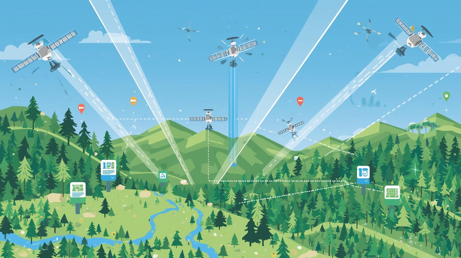
This is exactly the kind of problem AI-assisted remote monitoring was built to address. Platforms that combine frequent satellite imagery with machine-learning change detection now let land trusts watch their properties from above, every month or even more often, and get alerted when something on the ground changes. Tools like Lens by Upstream Tech, developed in partnership with The Nature Conservancy, were designed specifically for land trusts to view satellite data from multiple sources, annotate imagery, and generate compliance reports. The Land Trust Alliance has even run grant programs to help organizations adopt remote monitoring technology.
This article is a practical guide for land trust leaders and stewardship staff who want to understand what AI can realistically do for property monitoring, easement compliance, and reporting, and how to bring it in without overpromising or abandoning the boots-on-the-ground judgment that conservation still requires. It complements our look at open-source wildlife AI tools for conservation organizations and our broader nonprofit leader's guide to getting started with AI.
Remote Property Monitoring From Above
The foundation of AI-assisted stewardship is frequent, analyzed satellite imagery. Instead of relying on a single annual visit, a land trust can review imagery of every protected property on a regular cadence, with software highlighting the places where the landscape has changed since the last look. This does not replace the trained eye of a steward, but it dramatically expands how often and how thoroughly properties can be watched.
Frequent, Year-Round Imagery
Modern monitoring platforms pull from multiple satellite sources to deliver regular imagery of each parcel, often monthly, rather than one snapshot per year. For organizations stewarding tens of thousands of acres of conservation restrictions, this guaranteed cadence has been described as a game-changer, surfacing timber harvests, new clearings, and development between site visits rather than long after.
Automated Change Detection
Rather than asking a staff member to eyeball every image, machine-learning models compare imagery over time and flag meaningful changes, vegetation loss, new impervious surfaces, soil disturbance, water-level shifts, so attention goes straight to the parcels that need it. The software does the tedious scanning; the human decides what the flagged change actually means.
Smarter, Better-Targeted Field Visits
Remote monitoring does not eliminate the site visit; it makes it sharper. When staff do drive out, they already know which corner of the property to inspect and what to look for. Organizations using these tools report being able to focus ground visits where they matter and free up capacity for other critical stewardship work, stretching small teams across larger portfolios.
The combined effect is a shift from reactive, once-a-year checking to continuous, prioritized awareness. A land trust that once learned about problems months late can now catch them while they are small, which is precisely when intervention is cheapest and most effective.
Easement Compliance and Early Violation Detection
A conservation easement is a legal agreement that restricts what can be done on a piece of land, even as ownership changes hands over generations. Upholding it requires the land trust to know, reliably and continuously, whether the terms are being honored. AI-assisted monitoring strengthens that core duty in several concrete ways, turning compliance from an annual scramble into an ongoing, documented practice.
Catching Violations Early
Unauthorized structures, road-building, tree clearing, grading, and dumping all leave visible marks from above. Frequent imagery and change alerts mean these can be spotted within weeks rather than at the next annual visit, when a quiet conversation with a landowner can often resolve the issue before it escalates into a costly legal dispute.
Building a Defensible Record
Should a violation ever reach litigation, a consistent, time-stamped imagery record showing the property's condition over years is powerful evidence. Remote monitoring creates that history automatically, supplementing baseline documentation reports and on-the-ground photos with an objective view from above.
Tracking Change Across Ownership
Easements bind future owners who may not fully understand the restrictions they inherited. Continuous monitoring helps a land trust spot well-meaning but unauthorized changes by new owners early, opening the door to education and correction rather than confrontation.
Monitoring Ecological Condition
Beyond catching violations, the same imagery can track the health of the land itself: vegetation vigor, drought stress, wetland extent, and recovery after restoration. This turns compliance monitoring into a richer picture of whether the conservation values the easement protects are actually thriving.
For accredited land trusts and those pursuing accreditation, this also supports the rigorous monitoring and documentation standards the field expects. Demonstrating that every property is monitored at least annually, with records to prove it, is far more achievable when remote tools handle the routine watching and field staff concentrate on the parcels and questions that genuinely need a human on site.
Stewardship Reporting and Documentation
Monitoring is only half the obligation; documenting it is the other half. A land trust that watches its properties diligently but cannot produce clear records has not met the standard that accreditation, funders, and legal defense require. This is where AI-assisted tools quietly save the most staff time, because the reporting that once consumed evenings and weekends can be substantially automated.
Generating Monitoring Reports
Monitoring platforms increasingly let staff annotate imagery, note observations, and generate compliance reports directly from the same system used to review properties. Instead of assembling a report from scattered photos, field notes, and maps after the fact, the documentation is built as the monitoring happens, complete with dated imagery and a record of what was reviewed.
Summarizing and Drafting With Language Models
General-purpose AI writing tools can take a steward's bullet-point observations and draft a clear narrative summary, or condense a year of monitoring activity into a board-ready overview. A human always reviews and signs off, but the blank-page burden of writing dozens of reports shrinks considerably. The same approach helps with the funder and grant reporting that stewardship work depends on, as we discuss in our guide to AI for grant reporting.
Keeping Records Organized and Findable
Perpetuity means records must outlast the staff who created them. AI tools can help tag, organize, and search a growing archive of monitoring reports, baseline documents, and imagery so that a steward five or twenty years from now can quickly find the history of any property. Good documentation is only useful if a future colleague can actually retrieve it.
The payoff is not just saved hours. It is documentation that is more consistent, more complete, and more defensible than what a stretched team could produce by hand, which is exactly what a perpetual obligation demands.
Getting Started Without Overreaching
Adopting these tools is well within reach of even a small land trust, but it pays to start deliberately rather than trying to transform everything at once. The organizations that succeed treat technology as an addition to their stewardship program, not a replacement for the field knowledge and landowner relationships that remain at its heart.
Start with your highest-risk properties
Pilot remote monitoring on the parcels that are hardest to reach, most development-pressured, or have a history of issues. Proving value on a focused set builds confidence and a clear case before expanding to the full portfolio.
Explore grants and shared resources
The Land Trust Alliance and regional partners have offered grant programs and guidance specifically for adopting remote monitoring technology. Look for funding and peer organizations before assuming the cost falls entirely on your budget.
Keep a human in the loop on every alert
A change-detection flag is a prompt to investigate, not a verdict. Seasonal vegetation, cloud shadows, and benign activity all trigger alerts. Trained staff must interpret what the imagery shows and decide whether a visit or a conversation is warranted.
Preserve the landowner relationship
Monitoring from space should never feel like surveillance to the people who steward the land day to day. Be transparent with easement holders about how you monitor, and keep the annual visit and personal relationship central. Technology should support trust, not erode it.
Plan for the data over the long term
Because the obligation is perpetual, think about where imagery and reports live, who can access them, and how they will be maintained as platforms and staff change. Build the archive to outlast any single tool or vendor.
Approached this way, AI becomes a force multiplier for a mission that has always been bigger than the resources available to it. A two- or three-person stewardship team can credibly watch over a portfolio that would once have required many times the staff, without sacrificing the rigor that conservation in perpetuity demands.
Where the Technology Reaches Its Limits
For all its power, remote monitoring cannot do everything, and pretending otherwise would put a land trust at risk. Honest awareness of the limits is what separates organizations that use these tools well from those that lean on them too hard.
Keep These Realities in View
- Satellite imagery has resolution limits and can miss small structures, understory changes, or activity hidden by tree canopy that a ground visit would catch.
- Cloud cover, snow, and seasonal change can obscure imagery or generate false alarms that still require human judgment to sort out.
- Some easement terms involve conditions, water quality, species presence, interior building use, that no overhead view can assess.
- Legal defense and accreditation still rest on human-verified documentation; imagery supplements, but does not replace, the steward's report and signature.
The right mental model is augmentation, not automation. Remote monitoring tells you where to look and lets you look more often; trained people still decide what they are seeing and what to do about it. Land trusts that hold to that division of labor get the efficiency gains without ceding the judgment that perpetual stewardship requires. The same balance applies across conservation technology generally, including the species and habitat tools we cover in our guides to wildlife AI for conservation and animal welfare and wildlife AI.
Conclusion
Conservation land trusts have always faced a hard arithmetic: a permanent, growing obligation to monitor and defend protected land, set against the limited time and money of a small team. AI-assisted remote monitoring shifts that equation. Frequent satellite imagery and machine-learning change detection let a land trust watch every property far more often than annual visits allow, catch easement violations while they are still small, and build the time-stamped documentation that accreditation and legal defense depend on, all while freeing field staff to spend their on-site time where it matters most.
The key is to adopt these tools as an extension of good stewardship rather than a substitute for it. Start with your highest-risk properties, pursue the grants and shared resources the field offers, keep trained humans interpreting every alert, and protect the landowner relationships that make conservation work possible. Used that way, the technology multiplies the reach of a mission without diluting its rigor.
Perpetuity is a promise that outlasts every staff member who ever makes it. The land trusts embracing AI thoughtfully are not replacing the people who keep that promise. They are giving those people the tools to keep it more faithfully, across more land, for far longer than the old methods alone ever could.
Ready to Modernize Your Stewardship Program?
We help conservation and land-protection nonprofits adopt AI-assisted monitoring and reporting in ways that strengthen compliance without losing the human judgment stewardship requires. If you want help charting a practical path, we would be glad to talk it through.